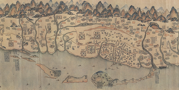
Taiwan map during the reign of Emperor Kangxi, 1722
Grand Taroko transport bird's-eye view, Hatsusaburo Yoshida, 1935
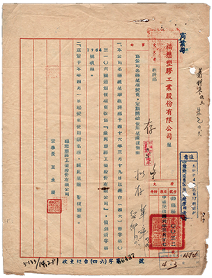
Document regarding Ten Major Construction Projects, 1957
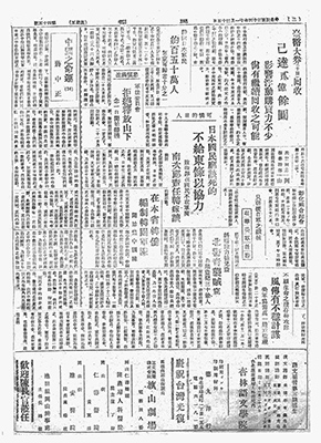
Newspaper - Around 1.5 million Japanese return home, 1945
The Republic of China joins the WTO, 2002
United Nations resolution to 758, 1971
Taipei, Taiwan
Hard surface transformations 1987-2011, color code
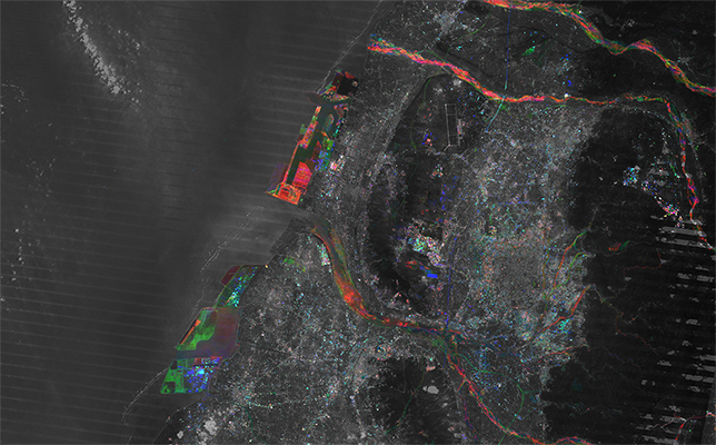
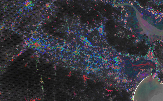
Taichung, Taiwan
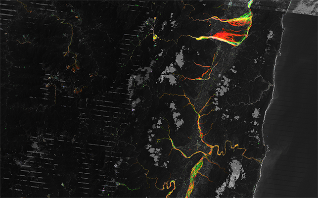
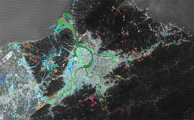
East coast of Taiwan, redirection of rivers
Transformations around the South China Sea
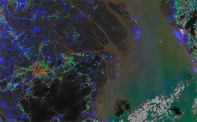
Pearl River Delta, Zhujiang River Estuary, China
Chaonan estuary, China
Documentation
The first set of documentary practices and materials stems from the National Archives of the Republic of China, and traces the complex political and cultural location of Taiwan. Moving from the colonial and imperial forms of modernity, the envisioned new infrastructures of the 21st Century reverberate with the long modern growl of the control, management and engineering techniques set in motion to govern flows and circulations of goods, materials, energy, populations, information, finance. These techniques accelerate in their turn the separation and distinction of the different paths that cross and make up contemporary space. What seems to emerge is a complex of systematic fragmentation and separation, which is aligning itself with the atomisation of independent work and the anti-political swerves of current public life. How to think of a space where the constructions of ethical subjects are entangled with the construction of their spaces of cohabitation?
Earth Observation
A second set of materials are organised in the museum through diachronic analysis. A vast crosssection of the satellite-data archive of the Landsat program reveals the transformations in the material spaces of human cohabitation. The constantly refreshed archive, which scans the surface of the entire earth from an orbit altitude of +/- 705 km, is sampled at three decades intervals from the end of martial law in the ROC. The materials that form the surface of the earth in this region are mapped and analysed in their transformation processes. Sounding the spectrum between the frequencies of 0.45 – 0.52 µm, the electromagnetic reflections detected by the Landsat multiple sensors depict the transformations in the hard surfaces, those constituting the substrata, the infrastructure of human activities. These are markers of complex procedures to control, modulate, contain and frame the shifting links, the disetaneous sets of transformations between the form of contemporary polity and contemporary space.